
Official partner of


Who we are
EquipGIS is a bonded, licensed and insured spatial data and software solutions firm based in the Greater Boston Area. We specialize in striking the right balance between what’s possible and what’s necessary to provide our clients with the most appropriate spatial data and tools possible. We support the leading established GIS platforms, such as Esri, MapBox and Carto, as well as custom and open-source alternatives, on-premises or in the cloud. Our services range from map making and custom application development to full-scale enterprise GIS implementation and management.

We support organizations and individuals around the world.

Our Services
We offer a wide range of spatial data and software services. Here are the most commonly requested ones.
 Planning
 A great GIS implementation always starts with a great GIS plan. We typically take a phased approach consisting of resource assessment, needs assessment and the development of a comprehensive GIS plan. Our plans are more than checklists and schedules; they are detailed plans to meet well-defined and measurable goals, carefully considering constraints and risks.
 Data
Data Data is the currency of information systems. If you want to maximize the value you get out of GIS, you must have valuable data. Do you need help finding it? Collecting it? Processing it? Analyzing it? If so, we can help. Our data services range from simple geocoding to designing enterprise-scale databases.
 Applications
 People most often interact with GIS using software applications. We believe that desktop, web and mobile applications should be intuitive, efficient and focused. They should empower users to extract value from spatial data. Our applications services include configuring off the shelf software to meet your needs and building custom solutions from the ground up.
 Training and Support
 A great GIS is of little value if people don’t know how to use or maintain it. We provide training and support services for end users, as well as maintenance staff. Our offerings include technical documentation, user manuals, hands-on tutorials, on-site and off-site instruction and email/phone support.
 Enterprise Implementation and Management
 Many organizations need GIS but lack the internal staff to implement or maintain it. We can fill the void by provided end-to-end implementation and management services. Our team has experience implementing and maintaining enterprise GIS for organizations ranging in size from small businesses to government agencies.
Our Work
Radar for Life
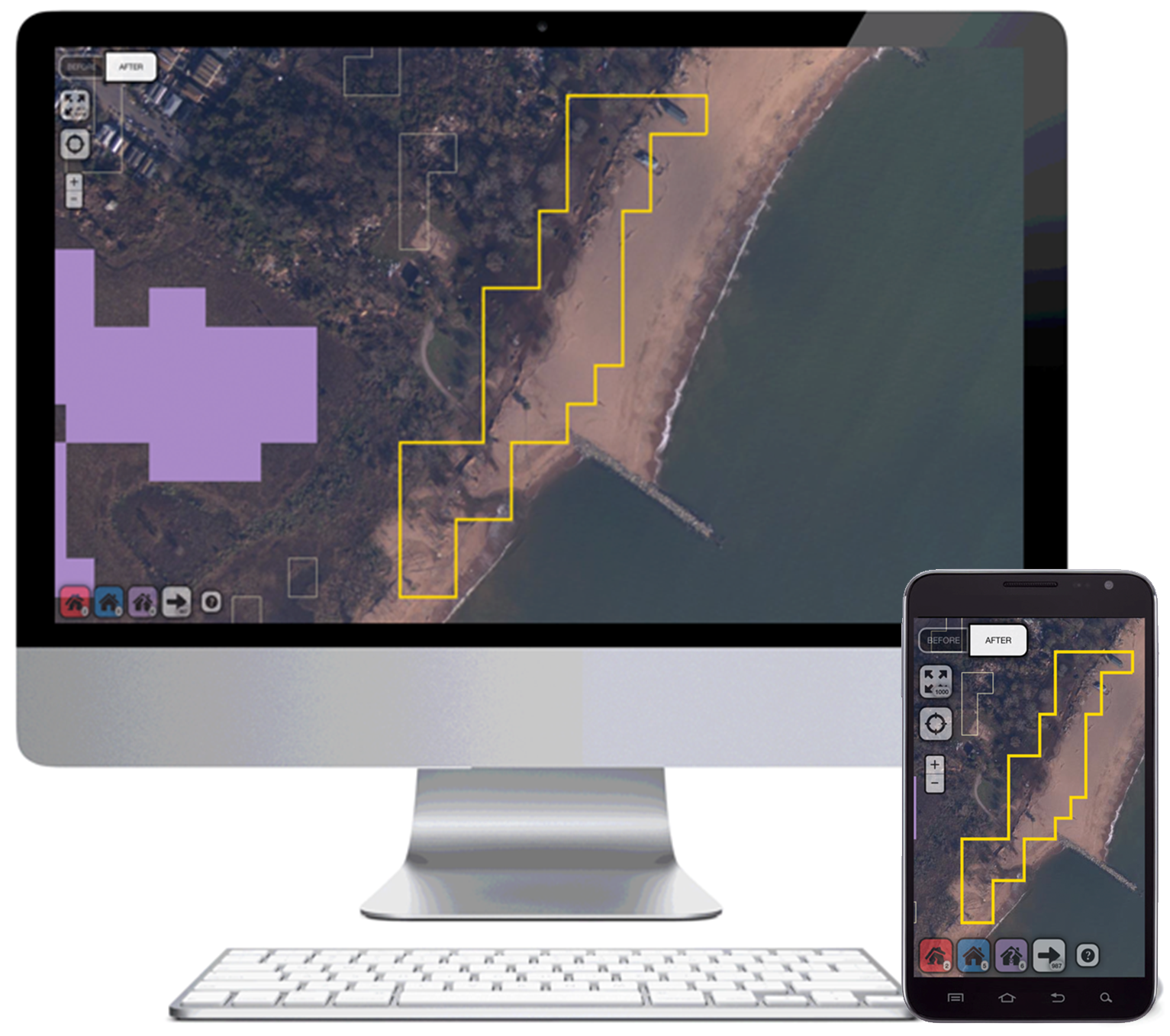
Radar for Life is a location-based decision support system that provides disaster response and relief efforts with unique, validated maps of damaged areas following natural disasters. Radar for Life leverages radar satellite imagery and a "damage proxy map.
It also features tools to remotely validate damage using pre- and post-event optical imagery, either in a controlled or crowd-sourced environment.
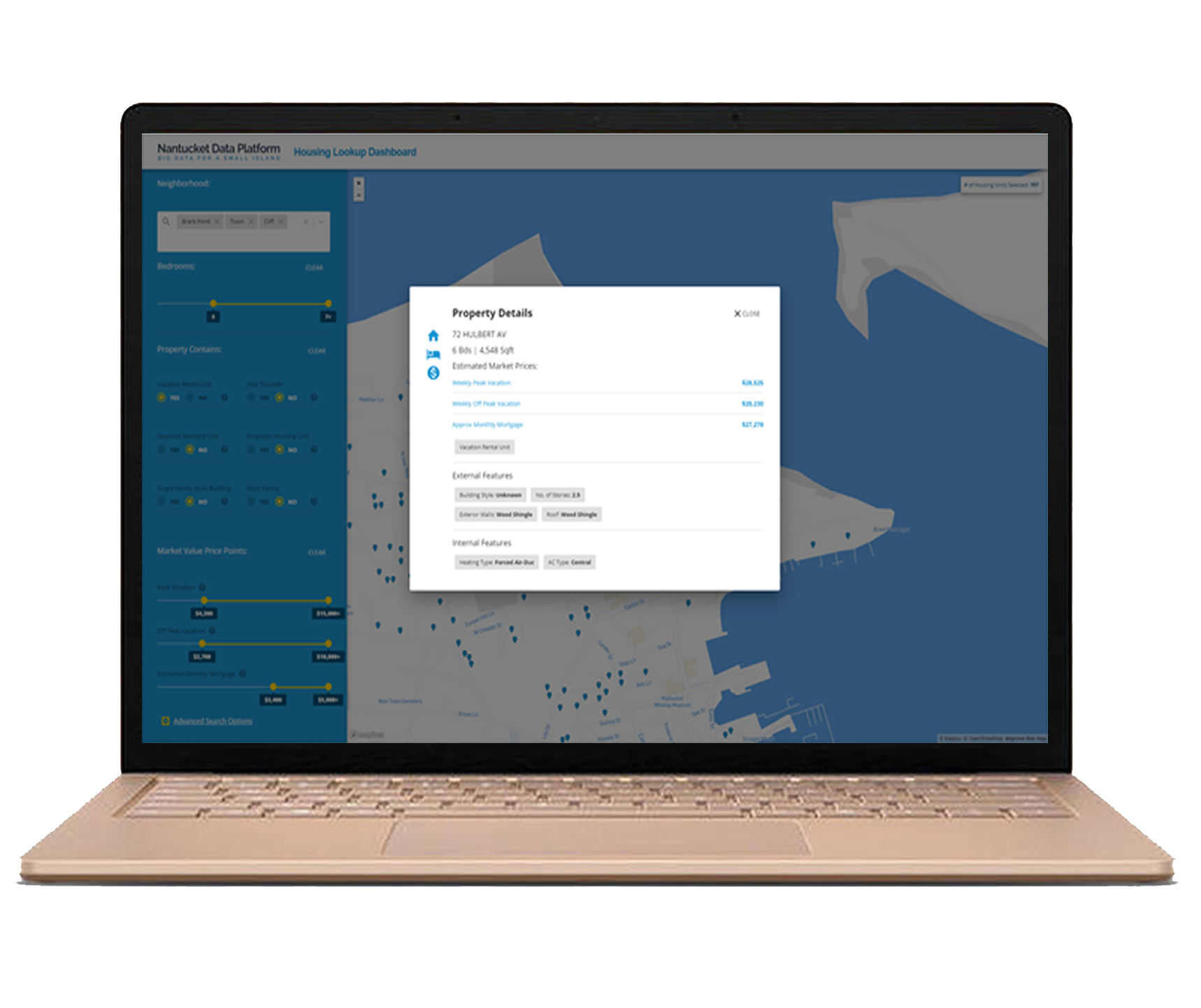

Accuarte housing demand data
Detailed portal to analyse & make decision
Affordable Housing Map
Its a web application used by local governments and other organizations to monitor, assess and plan affordable housing initiatives. It integrates housing supply databases with a survey-driven housing demand model to provide a complete picture of the housing market. It offers detailed mapping, filtering and reporting tools that enable data-driven approaches not typically seen in the industry.
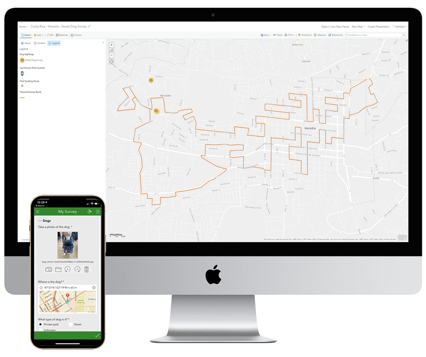
Global Dog Campaign App Suite
The Global Dog Campaign App Suite is a set of spatial applications being used to conduct surveys and perform analyses about the dog population all over the world. The purpose of the Suite is to establish the most accurate data on the global dog population and provide that information to researchers, nonprofits and other stakeholders who are working hard to improve the wellbeing of animals, people and the environment.
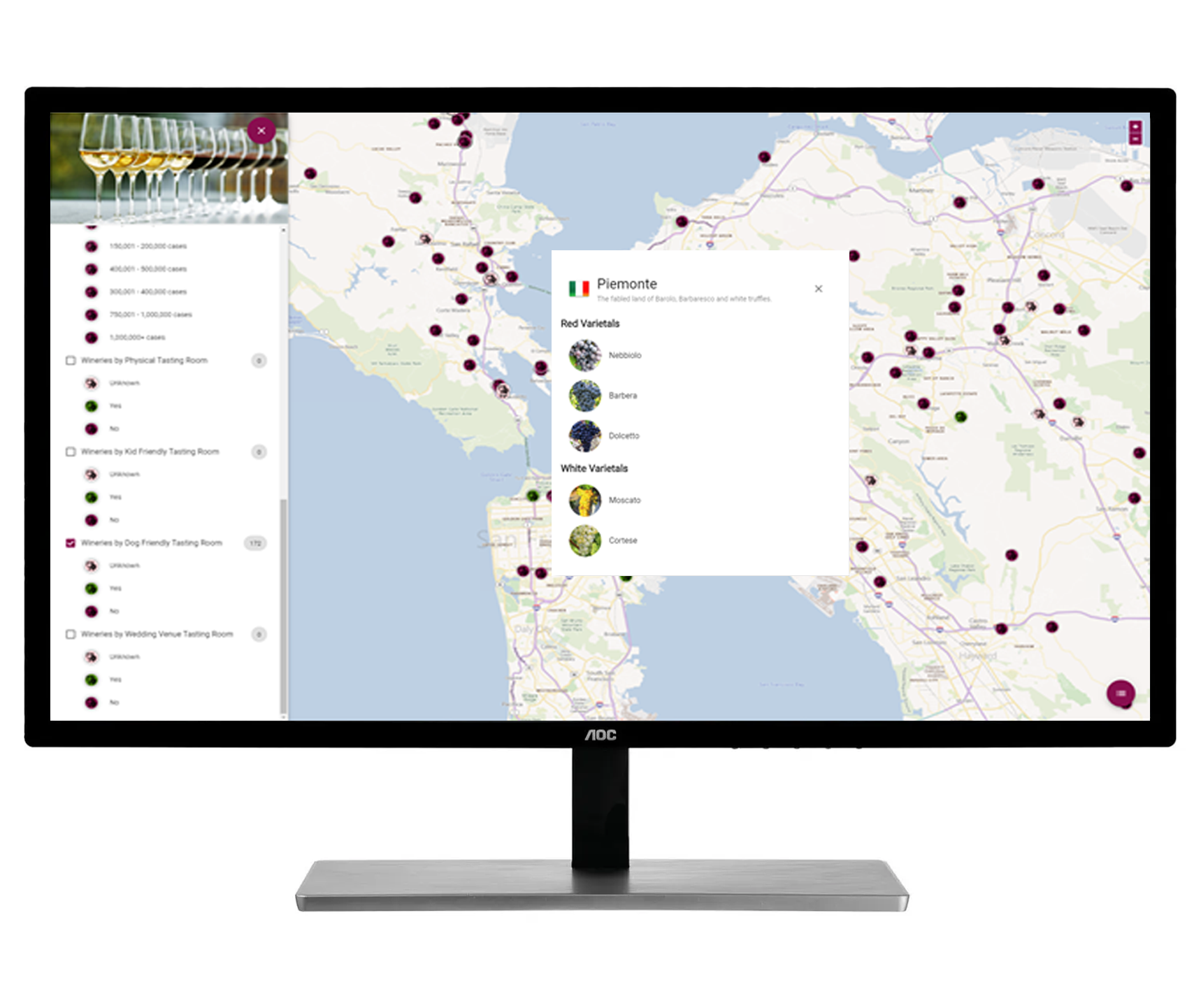
Where To Wine
WhereToWine is a web mapping application that makes finding the perfect winery easy. Are you looking for a winery with reasonably-priced bottles and that varietal you can't seem to find anywhere? Or a winery that allows you to bring your kids and dog into the tasting room? WhereToWine can help by filtering wineries in your target area to only those that meet your unique criteria.
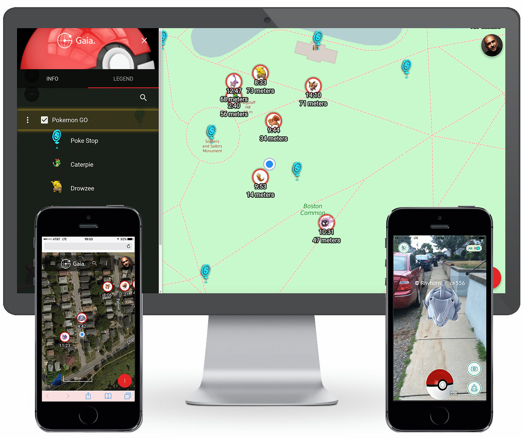
Poke Trail
PokeTrail is a GIS companion application for the hit mobile game Pokemon Go. In Pokemon Go, virtual creatures spawn for short periods of time throughout the real world. Players wander around trying to find and capture them before they disappear. PokeTrail makes this much easier by showing players exactly where pokemon are and when they'll disappear. It accomplishes this by integrating directly with Pokemon Go's official game servers and presenting the information in a mobile-friendly web application that works globally.
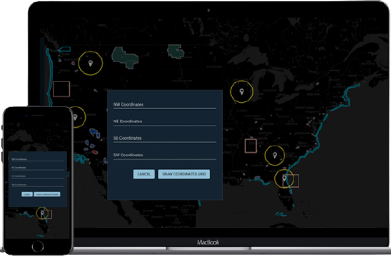
802 Mapper
802Mapper is the most comprehensive Committee on Foreign Investment in the United States (CFIUS) mapping tool on the market. It enables users to conduct efficient and methodical spatial analyses for CFIUS risk assessment, notification and filing purposes. 802Mapper integrates spatial information on military installations, Public Land Survey System (PLSS) areas, airports, seaports and more to provide a one stop shop for relevant data. It also features powerful analysis and reporting tools that turn days of manual analysis into a few button clicks.

Our Team
Our team has over a decade of experience working together to provide spatial data and software solutions.

Josh Coefer
President

Ty Swavely
GIS Developer

Jeff McCloud
Software Engineer

Marlynn Mabhena
Contract Manager

Steven Theer
Systems Administrator

Jon Janezic
Customer Support

Patrick Godbey
Software Engineer

Scully
Canine Operations Director
Let us know how we can help you become spatially equipped.